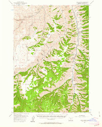
1954 Map of Harl Butte
USGS Topo · Published 1963About this map
The Imnaha River carves a deep path through Wallowa County, defining the eastern half of this 1950s survey. This remote area, characterized by high ridges like Clear Lake Ridge and Dead Horse Ridge, supported a scattered community of ranchers and foresters. Local social life is anchored by the Imnaha Grange, while evidence of earlier settlement patterns appears in the decommissioning of remote education sites like Freezeout Sch and The Park School. The presence of the College Creek Ranger Station and a lookout at Harl Butte emphasizes the significance of fire management in this heavily timbered landscape. High-altitude meadows such as Marr Flat and specialized terrain features like Saulsberry Saddle provide specific landmarks for those tracing historical land use in this part of the Wallowa National Forest.
Find a feature on this map
94 named features on this map. Tap any name to fly to it.
Don’t see what you’re looking for? This feature index may not catch every label — zoom into the map to look around manually.
Map Details
Editions of this 1954 Harl Butte Map
3 editions found
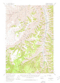
Other maps of this area

1920 · Seven Devils Mining District
USGS Topo · 1:48,000

1922 · He Devil
USGS Topo · 1:48,000

1954 · Cornucopia
USGS Topo · 1:62,500

1954 · Imnaha
USGS Topo · 1:62,500

1954 · Kernan Point
USGS Topo · 1:62,500

1954 · Harl Butte
USGS Topo · 1:62,500

1955 · Grangeville
USGS Topo · 1:250,000

1957 · Joseph
USGS Topo · 1:62,500

1957 · He Devil
USGS Topo · 1:62,500

1957 · Cuprum
USGS Topo · 1:62,500