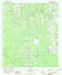
1982 Map of Harleston
USGS Topo · Published 1982About this map
The settlement of Old Americus lies near the boundary of George and Jackson Counties, situated along the complex drainage system of the Pascagoula River State Wildlife Management Area. This 1982 survey illustrates a landscape defined by its waterways and small rural communities, including Harleston, Wade, and Hurley. The presence of numerous family-named burial grounds like Steede Cem and Carter Cem, alongside rural landmarks such as Johnson Chapel and Good Hope Ch, provides significant data for genealogical research in this part of Mississippi. To the south, the terrain becomes increasingly swampy, dominated by the Black Creek and Honey Island Slough systems. This map captures the region's character through its transition from upland settlements to the riverine bottomlands, featuring points like Parkers Island and Straw Island within the wildlife management boundaries.
Find a feature on this map
39 named features on this map. Tap any name to fly to it.
Don’t see what you’re looking for? This feature index may not catch every label — zoom into the map to look around manually.
Map Details
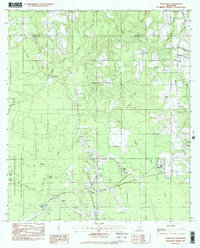
Editions of this 1982 Harleston Map
2 editions found
Other maps of this area

1941 · Hurley
USGS Topo · 1:62,500

1941 · Vancleave
USGS Topo · 1:62,500

1941 · Lucedale
USGS Topo · 1:62,500

1942 · Wilmer
USGS Topo · 1:62,500

1943 · Lucedale
USGS Topo · 1:62,500

1943 · Hurley
USGS Topo · 1:62,500

1943 · Vancleave
USGS Topo · 1:62,500

1944 · Wilmer
USGS Topo · 1:62,500

1944 · Vancleave
USGS Topo · 1:62,500

1953 · Mobile
USGS Topo · 1:250,000