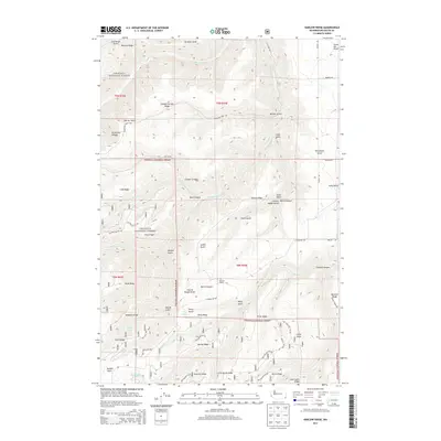
2014 Map of Harlow Ridge
USGS Topo · Published 2014About this map
The rugged drainage systems of N Fork Asotin Cr and S Fork Asotin Cr define this territory within the Umatilla National Forest. This 2014 survey records a landscape of high ridges and deep canyons, including Smoothing Iron Ridge, Harlow Ridge, and Bracken Ridge. The presence of E A Parsons Ranch and Hawks Run Airport near the northeastern boundary indicates localized agricultural and aviation activity amidst the timbered slopes. Significant for hydrologic study, the map labels numerous water sources such as Park Spring, Sheriff Spring, and Vogan Spring tucked into the gulches. The terrain is crisscrossed by forest service roads like Nat For Dev Rd 148, providing access to the remote Triple Ridge and Hogback Ridge. This data reflects the modern management of these highlands, where resource extraction and conservation intersect in the Blue Mountains region.
Find a feature on this map
66 named features on this map. Tap any name to fly to it.
Don’t see what you’re looking for? This feature index may not catch every label — zoom into the map to look around manually.
Map Details
Editions of this 2014 Harlow Ridge Map
This is the sole edition of this map. No revisions or reprints were ever made.
Other maps of this area

1943 · Peola
USGS Topo · 1:62,500

1943 · Saddle Butte
USGS Topo · 1:62,500

1944 · Anatone
USGS Topo · 1:62,500

1945 · Clarkston
USGS Topo · 1:62,500

1946 · Saddle Butte
USGS Topo · 1:62,500

1946 · Peola
USGS Topo · 1:62,500

1946 · Anatone
USGS Topo · 1:62,500

1948 · Clarkston
USGS Topo · 1:62,500

1955 · Pullman
USGS Topo · 1:250,000

1958 · Pullman
USGS Topo · 1:250,000