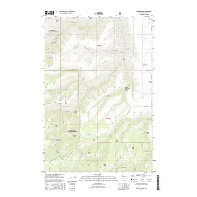
2017 Map of Harlow Ridge
USGS Topo · Published 2017About this map
Umatilla National Forest defines the western portion of this landscape, where the Blue Mountains transition into the deep drainages of Asotin County. The area is marked by a distinctive network of high ridges and narrow gulches, most notably Smoothing Iron Ridge and Triple Ridge. This 2017 survey details a landscape primarily accessible through a system of forest service roads and established backcountry paths like the S Asotin Creek Trail and Red Hill Gulch Trail. The drainages of N Fork Asotin Creek and George Cr cut through the terrain, while numerous named springs, such as Sheriff Spring and Petty Spring, indicate vital water sources for local livestock or wildlife. Named features like Horsethief Canyon and Stringtown Gulch suggest a history of frontier usage and localized settlement within these folds of land.
Find a feature on this map
77 named features on this map. Tap any name to fly to it.
Don’t see what you’re looking for? This feature index may not catch every label — zoom into the map to look around manually.
Map Details
Editions of this 2017 Harlow Ridge Map
This is the sole edition of this map. No revisions or reprints were ever made.
Other maps of this area

1943 · Peola
USGS Topo · 1:62,500

1943 · Saddle Butte
USGS Topo · 1:62,500

1944 · Anatone
USGS Topo · 1:62,500

1945 · Clarkston
USGS Topo · 1:62,500

1946 · Saddle Butte
USGS Topo · 1:62,500

1946 · Peola
USGS Topo · 1:62,500

1946 · Anatone
USGS Topo · 1:62,500

1948 · Clarkston
USGS Topo · 1:62,500

1955 · Pullman
USGS Topo · 1:250,000

1958 · Pullman
USGS Topo · 1:250,000