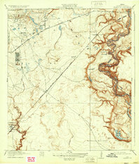
1920 Map of Harmaston
USGS Topo · Published 1933About this map
The San Jacinto River meanders through the eastern reaches of this Harris County survey, defining a landscape of oxbow lakes and wetlands like Mud Lake, McCormick L, and the wide Ingrando Marsh. This early 20th-century landscape is dominated by the nascent oil industry and historic transit corridors. A significant cluster of Oil Tanks sits near the headwaters of Garners Bayou, signaling the region's industrial shift, while the Atascocita Road and Atascocita Ferry preserve the route of one of Texas's oldest overland trails. Small rail-side settlements such as Harmaston, Spencer, and Victor dot the line of the Beaumont and Western Sour Lake railway. The western portion of the map is shaped by a dense network of drainage systems including Williams Gully and Greens Bayou, which would eventually become central to the development of the northeast Houston area.
Find a feature on this map
23 named features on this map. Tap any name to fly to it.
Don’t see what you’re looking for? This feature index may not catch every label — zoom into the map to look around manually.
Map Details
Editions of this 1920 Harmaston Map
2 editions found

Other maps of this area

1916 · Burnett Bay
USGS Topo · 1:24,000

1916 · Crosby
USGS Topo · 1:24,000

1916 · Settegast
USGS Topo · 1:24,000

1916 · Fauna
USGS Topo · 1:24,000

1916 · Harmaston
USGS Topo · 1:24,000

1916 · Moonshine Hill
USGS Topo · 1:24,000

1916 · Huffman
USGS Topo · 1:24,000

1916 · Humble
USGS Topo · 1:24,000

1919 · Humble
USGS Topo · 1:31,680

1919 · Weeden
USGS Topo · 1:31,680