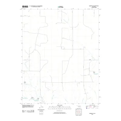
2010 Map of Harmon SE
USGS Topo · Published 2010About this map
Lone Star Cemetery stands as a quiet landmark in this Ellis County landscape, situated on a high point overlooking the headwaters of South Turkey Creek. This 2010 survey reflects a rural Oklahoma geography defined by a systematic grid of county roads, such as N1930 Rd and E0680 Rd, which cut through a terrain etched by winding drainages. The local economy and land use are clearly tied to water management, as evidenced by numerous small-scale impoundments including Little Cottonwood Lake, Richardson Lake, and the Harris Number 1 Reservoir. These water bodies, often associated with named dams like the Davison Number 2 Dam, are distributed along the intricate creek systems of Hackberry Creek and Mott Creek, illustrating how the agricultural environment is shaped by the control of seasonal runoff.
Find a feature on this map
30 named features on this map. Tap any name to fly to it.
Don’t see what you’re looking for? This feature index may not catch every label — zoom into the map to look around manually.
Map Details
Editions of this 2010 Harmon SE Map
This is the sole edition of this map. No revisions or reprints were ever made.
Other maps of this area

1955 · Clinton
USGS Topo · 1:250,000

1955 · Woodward
USGS Topo · 1:250,000

1957 · Clinton
USGS Topo · 1:250,000

1958 · Woodward
USGS Topo · 1:250,000

1961 · Leedey
USGS Topo · 1:62,500

1965 · Roll NE
USGS Topo · 1:24,000

1965 · Roll NW
USGS Topo · 1:24,000

1969 · Vici NW
USGS Topo · 1:24,000

1970 · Harmon
USGS Topo · 1:24,000

1970 · Harmon SW
USGS Topo · 1:24,000