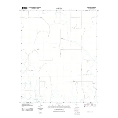
2012 Map of Harmon SE
USGS Topo · Published 2012About this map
Lone Star Cem is a quiet landmark on the eastern side of this Ellis County landscape, situated amidst a grid of section-line roads that define the rural character of the region. The area is defined by its intermittent drainage systems, including S Turkey Cr and the multiple forks of Hackberry Cr, which feed into various small basins and reservoirs. Water management is a central feature of the local topography, evidenced by the Harris Number 1 Reservoir and Davison Number 1 Reservoir. This 2012 survey illustrates the sparse but persistent ranching and farming infrastructure of Western Oklahoma, where lakes like Little Cottonwood Lake and Richardson Lake provide critical resources in an otherwise arid environment. The road network, primarily composed of numbered routes like n1900 RD and e0680 RD, connects the scattered water features and homesteads across this high plains terrain.
Find a feature on this map
28 named features on this map. Tap any name to fly to it.
Don’t see what you’re looking for? This feature index may not catch every label — zoom into the map to look around manually.
Map Details
Editions of this 2012 Harmon SE Map
This is the sole edition of this map. No revisions or reprints were ever made.
Other maps of this area

1955 · Clinton
USGS Topo · 1:250,000

1955 · Woodward
USGS Topo · 1:250,000

1957 · Clinton
USGS Topo · 1:250,000

1958 · Woodward
USGS Topo · 1:250,000

1961 · Leedey
USGS Topo · 1:62,500

1965 · Roll NE
USGS Topo · 1:24,000

1965 · Roll NW
USGS Topo · 1:24,000

1969 · Vici NW
USGS Topo · 1:24,000

1970 · Harmon
USGS Topo · 1:24,000

1970 · Harmon SW
USGS Topo · 1:24,000