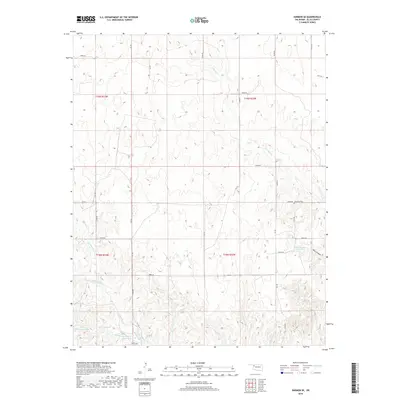
2018 Map of Harmon SE
USGS Topo · Published 2018About this map
Lone Star Cem sits on the high ground between the drainage basins of the Canadian River and the North Canadian River, a quiet landmark in the rural expanse of eastern Ellis County. This region is defined by its subtle hydrography and deep-cut draws, where small seasonal streams like S Turkey Cr and Mott Cr branch out across the landscape. The reliance on water management in this cattle-country terrain is evident in the man-made reservoirs dotting the townships, including Harris-Number 1 Reservoir and Davison Number 1 Reservoir. To the southwest, Little Cottonwood Lake and Richards Lake provide essential landmarks in an area otherwise characterized by a strict section-line road grid. The presence of Oats Canyon near the eastern edge suggests more varied relief where the land breaks toward larger creek beds like Devil Cr.
Find a feature on this map
37 named features on this map. Tap any name to fly to it.
Don’t see what you’re looking for? This feature index may not catch every label — zoom into the map to look around manually.
Map Details
Editions of this 2018 Harmon SE Map
This is the sole edition of this map. No revisions or reprints were ever made.
Other maps of this area

1955 · Clinton
USGS Topo · 1:250,000

1955 · Woodward
USGS Topo · 1:250,000

1957 · Clinton
USGS Topo · 1:250,000

1958 · Woodward
USGS Topo · 1:250,000

1961 · Leedey
USGS Topo · 1:62,500

1965 · Roll NE
USGS Topo · 1:24,000

1965 · Roll NW
USGS Topo · 1:24,000

1969 · Vici NW
USGS Topo · 1:24,000

1970 · Harmon
USGS Topo · 1:24,000

1970 · Harmon SW
USGS Topo · 1:24,000