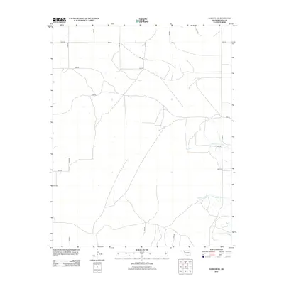
2012 Map of Harmon SW
USGS Topo · Published 2012About this map
Eddie Cem sits at the intersection of E0670 Rd and N1890 Rd, serving as a primary landmark in this rural landscape of Ellis County. The area is defined by a strictly organized grid of sectional roads, including N1830 Rd and N1840 Rd, which cut through the high plains terrain. Water resources appear concentrated in the southeastern portion of the map, where the courses of Hackberry Cr and W Hackberry Cr create natural breaks in the rectangular property lines. Small impoundments such as Carlton Lake and Little Cottonwood Lake provide localized water sources in an otherwise dry agricultural and ranching environment. This survey captures the enduring rural character of western Oklahoma, where the vast majority of human influence is represented by the section-line road network and isolated family-named sites.
Find a feature on this map
20 named features on this map. Tap any name to fly to it.
Don’t see what you’re looking for? This feature index may not catch every label — zoom into the map to look around manually.
Map Details
Editions of this 2012 Harmon SW Map
This is the sole edition of this map. No revisions or reprints were ever made.
Other maps of this area

1955 · Clinton
USGS Topo · 1:250,000

1955 · Woodward
USGS Topo · 1:250,000

1957 · Clinton
USGS Topo · 1:250,000

1958 · Woodward
USGS Topo · 1:250,000

1965 · Roll NE
USGS Topo · 1:24,000

1965 · Roll NW
USGS Topo · 1:24,000

1966 · Antelope Hills NE
USGS Topo · 1:24,000

1970 · Arnett
USGS Topo · 1:24,000

1970 · Harmon
USGS Topo · 1:24,000

1970 · Arnett SE
USGS Topo · 1:24,000