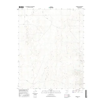
2016 Map of Harmon SW
USGS Topo · Published 2016About this map
Eddie Cem serves as a quiet historical anchor in this corner of Ellis County, situated among a network of rural section roads including E0670 Rd and NS 189. The landscape is defined by the drainage patterns of Hackberry Cr and its tributary, W Hackberry Cr, which flow through the eastern portion of the quadrangle. Small bodies of water, specifically Carlton Lake and Little Cottonwood Lake, provide distinct landmarks in an otherwise open terrain. This survey reflects the modern agricultural and ranching layout of the Oklahoma Panhandle region, where long-established cemetery sites like Eddie Cem remain one of the few named cultural markers alongside a systematic grid of numbered county roads such as N1830 Rd and E0620 Rd.
Find a feature on this map
17 named features on this map. Tap any name to fly to it.
Don’t see what you’re looking for? This feature index may not catch every label — zoom into the map to look around manually.
Map Details
Editions of this 2016 Harmon SW Map
This is the sole edition of this map. No revisions or reprints were ever made.
Other maps of this area

1955 · Clinton
USGS Topo · 1:250,000

1955 · Woodward
USGS Topo · 1:250,000

1957 · Clinton
USGS Topo · 1:250,000

1958 · Woodward
USGS Topo · 1:250,000

1965 · Roll NE
USGS Topo · 1:24,000

1965 · Roll NW
USGS Topo · 1:24,000

1966 · Antelope Hills NE
USGS Topo · 1:24,000

1970 · Arnett
USGS Topo · 1:24,000

1970 · Harmon
USGS Topo · 1:24,000

1970 · Arnett SE
USGS Topo · 1:24,000