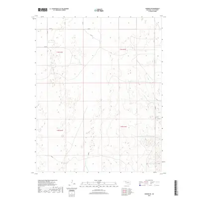
2018 Map of Harmon SW
USGS Topo · Published 2018About this map
Eddie Cem serves as a quiet landmark within the rural landscape of Ellis County, where the topography of the High Plains begins to fold into the drainages of the eastern Panhandle. The area is defined by the winding course of Hackberry Creek and its tributary, W Hackberry Creek, which carve through the terrain and feed localized bodies of water like Carlton Lake. The township and range lines for t19n r24w and t18n r23w reveal a strictly organized section-line road network, including routes such as E0620 Road and N1890 Road. This 2018 survey illustrates a contemporary view of Oklahoma ranchland, where water management features like Little Cottonwood Lake support the agricultural operations that have shaped this region for generations.
Find a feature on this map
20 named features on this map. Tap any name to fly to it.
Don’t see what you’re looking for? This feature index may not catch every label — zoom into the map to look around manually.
Map Details
Editions of this 2018 Harmon SW Map
This is the sole edition of this map. No revisions or reprints were ever made.
Other maps of this area

1955 · Clinton
USGS Topo · 1:250,000

1955 · Woodward
USGS Topo · 1:250,000

1957 · Clinton
USGS Topo · 1:250,000

1958 · Woodward
USGS Topo · 1:250,000

1965 · Roll NE
USGS Topo · 1:24,000

1965 · Roll NW
USGS Topo · 1:24,000

1966 · Antelope Hills NE
USGS Topo · 1:24,000

1970 · Arnett
USGS Topo · 1:24,000

1970 · Harmon
USGS Topo · 1:24,000

1970 · Arnett SE
USGS Topo · 1:24,000