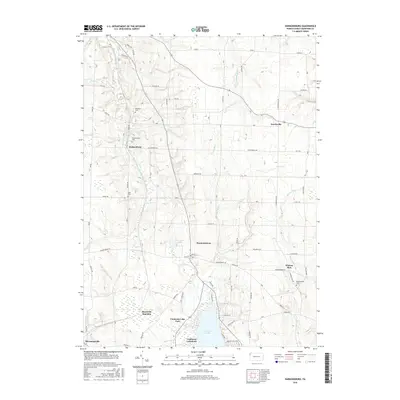
2016 Map of Harmonsburg
USGS Topo · Published 2016About this map
Harmonsburg and the surrounding rural townships of Crawford County are defined by a landscape shaped by glacial waters and early rail transit. The northern reaches of Conneaut Lake anchor the southern edge of this quadrangle, supporting local landmarks like Conneaut Lake Park and the lakeside community of Conneaut Lakeshore. The region's transport history is visible in the alignment of the Bessemer and Lake Erie RR, which connects agricultural hubs like Meadville Junction and Shermansville. Scattered throughout the township are numerous family and community burial grounds, including McDowell Cem, Dicksonburg Cem, and Breckenridge Cem, which provide essential points of reference for genealogists. Waterways like Inlet Run and Conneaut Creek feed into the lake, cutting through the farmland that separates smaller settlements such as Norrisville and Dicksonburg.
Find a feature on this map
66 named features on this map. Tap any name to fly to it.
Don’t see what you’re looking for? This feature index may not catch every label — zoom into the map to look around manually.
Map Details
Editions of this 2016 Harmonsburg Map
This is the sole edition of this map. No revisions or reprints were ever made.
Other maps of this area

1900 · Girard
USGS Topo · 1:62,500

1906 · Linesville
USGS Topo · 1:62,500

1908 · Linesville
USGS Topo · 1:62,500

1923 · Meadville
USGS Topo · 1:62,500

1923 · Cambridge Springs
USGS Topo · 1:62,500

1925 · Meadville
USGS Topo · 1:62,500

1925 · Cambridge Springs
USGS Topo · 1:62,500

1943 · Meadville
USGS Topo · 1:62,500

1943 · Cambridge Springs
USGS Topo · 1:62,500

1950 · Cleveland
USGS Topo · 1:250,000