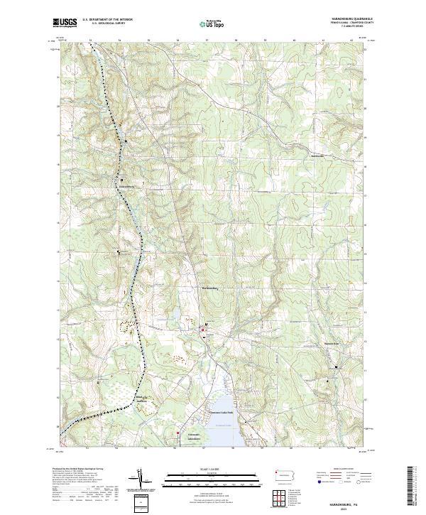
2023 Map of Harmonsburg
USGS Topo · Published 2023About this map
The Erie Extension Canal remains a defining landmark of this Crawford County landscape, cutting a path through the western terrain near Meadville Junction. This corridor, historic for its role in connecting the Ohio River to Lake Erie, parallels the meandering course of Conneaut Creek. The area is characterized by scattered rural settlements such as Dicksonburg and Harmonsburg, which are linked by an intricate grid of secondary roads like Dicksonburg Rd and S Center Rd.
Find a feature on this map
93 named features on this map. Tap any name to fly to it.
Don’t see what you’re looking for? This feature index may not catch every label — zoom into the map to look around manually.
Map Details
Editions of this 2023 Harmonsburg Map
This is the sole edition of this map. No revisions or reprints were ever made.
Other maps of this area

1900 · Girard
USGS Topo · 1:62,500

1906 · Linesville
USGS Topo · 1:62,500

1908 · Linesville
USGS Topo · 1:62,500

1923 · Meadville
USGS Topo · 1:62,500

1923 · Cambridge Springs
USGS Topo · 1:62,500

1925 · Meadville
USGS Topo · 1:62,500

1925 · Cambridge Springs
USGS Topo · 1:62,500

1943 · Meadville
USGS Topo · 1:62,500

1943 · Cambridge Springs
USGS Topo · 1:62,500

1950 · Cleveland
USGS Topo · 1:250,000
Featured Places
- Hayfield Township, PA
- Vernon Township, PA
- Summerhill Township, PA
- Sadsbury Township, PA
- Conneaut Lake Park, PA