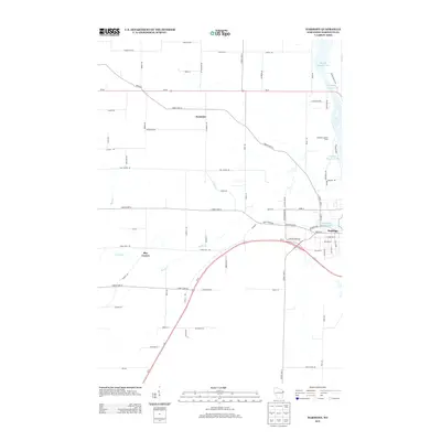
2013 Map of Harmony
USGS Topo · Published 2013About this map
The Peshtigo riverfront and its surrounding rural townships dominate this Marinette County landscape, where the town of Peshtigo sits at the edge of the river's significant hydroelectric and industrial infrastructure. The map documents the northern reaches of the settlement, showing the Peshtigo Flowage 1086 and Bagley Flowage 1061 as they widen the river's course. West of the water, the terrain is defined by a grid of farm roads and small agricultural clusters, including Harmony and May Corner. Local drainage through the fields is managed by Bundy Cr and Trout Cr, which eventually lead back toward the river valley. Notable landmarks from this era include the Peshtigo Lookout Tower and the corridor of Wi-64, which serves as a primary east-west artery through the township, connecting the more densely settled areas near the river to the sprawling timber and dairy lands further inland.
Find a feature on this map
75 named features on this map. Tap any name to fly to it.
Don’t see what you’re looking for? This feature index may not catch every label — zoom into the map to look around manually.
Map Details
Editions of this 2013 Harmony Map
This is the sole edition of this map. No revisions or reprints were ever made.
Other maps of this area

1939 · Marinette
USGS Topo · 1:48,000

1939 · Porterfield
USGS Topo · 1:48,000

1942 · Porterfield
USGS Topo · 1:48,000

1954 · Escanaba
USGS Topo · 1:250,000

1954 · Manitowoc
USGS Topo · 1:250,000

1956 · Oconto
USGS Topo · 1:62,500

1957 · Escanaba
USGS Topo · 1:250,000

1958 · Escanaba
USGS Topo · 1:250,000

1958 · Manitowoc
USGS Topo · 1:250,000

1961 · Little Sturgeon
USGS Topo · 1:62,500