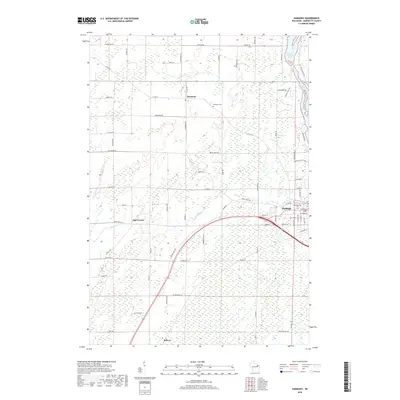
2018 Map of Harmony
USGS Topo · Published 2018About this map
Peshtigo and the rural communities of Harmony and May Corner define the landscape of Marinette County in this 2018 survey. The map details a transition from the structured street grid of southern Peshtigo to the expansive agricultural and wooded tracts of the north. Significant water features such as Bagley Flowage 1061 and the winding course of Bundy Cr shape the drainage patterns of the region. Local history is anchored by the Harmony Cem and Peshtigo Cem, providing essential points of reference for genealogists. The road network, including family-named routes like Rehms Rd and Jandt Rd, alongside the legacy suggested by Red School Rd, illustrates the deep-rooted settlement patterns of this Wisconsin timber and farming corridor.
Find a feature on this map
75 named features on this map. Tap any name to fly to it.
Don’t see what you’re looking for? This feature index may not catch every label — zoom into the map to look around manually.
Map Details
Editions of this 2018 Harmony Map
This is the sole edition of this map. No revisions or reprints were ever made.
Other maps of this area

1939 · Marinette
USGS Topo · 1:48,000

1939 · Porterfield
USGS Topo · 1:48,000

1942 · Porterfield
USGS Topo · 1:48,000

1954 · Escanaba
USGS Topo · 1:250,000

1954 · Manitowoc
USGS Topo · 1:250,000

1956 · Oconto
USGS Topo · 1:62,500

1957 · Escanaba
USGS Topo · 1:250,000

1958 · Escanaba
USGS Topo · 1:250,000

1958 · Manitowoc
USGS Topo · 1:250,000

1961 · Little Sturgeon
USGS Topo · 1:62,500