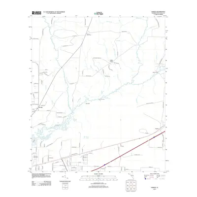
2012 Map of Harold
USGS Topo · Published 2012About this map
Blackwater River snakes through the heart of this landscape, its path defined by numerous oxbows and basins including Big Eddy, Half Moon Lake, and Clear Basin. The area is characterized by a dense network of named creeks and branches such as Earnest Mill Cr, Wasteway Br, and Big Juniper Cr that feed into the main river system. Human activity is clustered around the small settlements of Harold and Roeville, while the surrounding terrain is marked by aviation and forestry landmarks.
Find a feature on this map
111 named features on this map. Tap any name to fly to it.
Don’t see what you’re looking for? This feature index may not catch every label — zoom into the map to look around manually.
Map Details
Editions of this 2012 Harold Map
This is the sole edition of this map. No revisions or reprints were ever made.
Other maps of this area

1920 · Milton
USGS Topo · 1:62,500

1934 · Harold
USGS Topo · 1:62,500

1937 · Harold
USGS Topo · 1:62,500

1938 · Harold
USGS Topo · 1:62,500

1941 · Milton
USGS Topo · 1:62,500

1943 · Milton
USGS Topo · 1:62,500

1943 · Jay
USGS Topo · 1:62,500

1948 · Munson
USGS Topo · 1:62,500

1950 · Munson
USGS Topo · 1:62,500

1957 · Pensacola
USGS Topo · 1:250,000