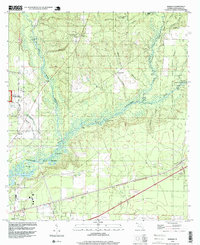
1994 Map of Harold
USGS Topo · Published 1999About this map
The Blackwater River dominates this portion of Santa Rosa County, winding through the Blackwater River State Forest and a series of expansive wetlands including Manning Basin and Cooper Basin. In the mid-1990s, the landscape was a mix of conservation land and military infrastructure, anchored by the presence of the Whiting Field U S Naval Air Sta and Milton T Field. The settlement of Harold sits at the intersection of the regional road and rail network, while the smaller community of Roeville lies further west. Notable landmarks for local history include the Coldwater Lookout Tower and Pleasant Home Church, which speak to the area's forestry roots and early community centers. Outdoor recreation is represented by the Heritage State Trail and Blackwater River State Park, showing the evolving use of the river corridor.
Find a feature on this map
43 named features on this map. Tap any name to fly to it.
Don’t see what you’re looking for? This feature index may not catch every label — zoom into the map to look around manually.
Map Details
Editions of this 1994 Harold Map
This is the sole edition of this map. No revisions or reprints were ever made.
Other maps of this area

1920 · Milton
USGS Topo · 1:62,500

1934 · Harold
USGS Topo · 1:62,500

1937 · Harold
USGS Topo · 1:62,500

1938 · Harold
USGS Topo · 1:62,500

1941 · Milton
USGS Topo · 1:62,500

1943 · Milton
USGS Topo · 1:62,500

1943 · Jay
USGS Topo · 1:62,500

1948 · Munson
USGS Topo · 1:62,500

1950 · Munson
USGS Topo · 1:62,500

1957 · Pensacola
USGS Topo · 1:250,000