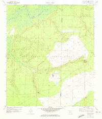
1970 Map of Harold SE
USGS Topo · Published 1973About this map
Yellow River bottomlands dominate the northern portion of this landscape, where the waterway meanders past Miller Bluff and Flowers Field Landing. The presence of Parkerville and the Flowers Field Cem suggests small riverine communities and family holdings established long before the military expansion of the mid-20th century. South of the river, the terrain rises into the sandy uplands of Eglin Air Force Base, showing a distinct shift in land use from the swampy tributaries like Boiling Creek and Indigo Creek to aviation infrastructure.
Find a feature on this map
41 named features on this map. Tap any name to fly to it.
Don’t see what you’re looking for? This feature index may not catch every label — zoom into the map to look around manually.
Map Details
Editions of this 1970 Harold SE Map
2 editions found
Other maps of this area

1921 · Holley
USGS Topo · 1:62,500

1934 · Holt
USGS Topo · 1:48,000

1934 · Harold
USGS Topo · 1:62,500

1936 · Holley
USGS Topo · 1:48,000

1937 · Holt
USGS Topo · 1:62,500

1937 · Harold
USGS Topo · 1:62,500

1938 · Mary Esther
USGS Topo · 1:62,500

1938 · Holley
USGS Topo · 1:62,500

1938 · Harold
USGS Topo · 1:62,500

1956 · Fort Walton Beach
USGS Topo · 1:62,500