
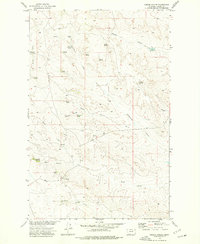
1971 Map of Harper Camp
USGS Topo · Published 1974About this map
Fort Peck Lake dominates the southern landscape of this 1971 survey, where the Missouri River forms the boundary between Valley and Garfield counties. Much of the shoreline and the broken breaks to the north are protected as part of the Charles M Russell National Wildlife Range. The terrain is characterized by high ridges and drainage systems, most notably Harper Ridge and the winding course of Carpenter Creek. Small, isolated landmarks like Grave, Little Snow, and Grizzly provide specific points of reference across the high ground. Evidence of local activity is sparse, concentrated at the Harper Camp settlement and a network of Jeep Trails that navigate the ridges and springs. This map captures the region after the completion of the dam changed the river valley into a massive reservoir, creating a complex shoreline of inlets and points.
Find a feature on this map
15 named features on this map. Tap any name to fly to it.
Don’t see what you’re looking for? This feature index may not catch every label — zoom into the map to look around manually.
Map Details
Editions of this 1971 Harper Camp Map
This is the sole edition of this map. No revisions or reprints were ever made.
Other maps of this area

1954 · Jordan
USGS Topo · 1:250,000

1956 · Jordan
USGS Topo · 1:250,000

1958 · Jordan
USGS Topo · 1:250,000

1958 · Collins Ranch
USGS Topo · 1:62,500

1958 · Maloney Hill
USGS Topo · 1:62,500

1964 · Jordan
USGS Topo · 1:250,000

1971 · Hell Hollow
USGS Topo · 1:24,000

1971 · Trumbo Ranch
USGS Topo · 1:24,000

1971 · Wagon Coulee
USGS Topo · 1:24,000
1973 · Gibson Coulee
USGS Topo · 1:24,000