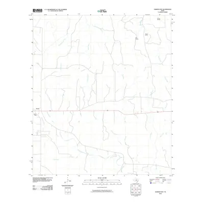
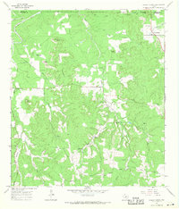
2010 Map of Harper East
USGS Topo · Published 2010About this map
Harper sits on the western edge of this landscape, serving as a gateway to the intricate drainage network of the Texas Hill Country in the early 21st century. The terrain is defined by a dense system of seasonal and perennial waterways, including the upper reaches of the Pedernales River and Pecan Creek. The map documents a landscape of numerous named hollows and draws, such as Spring Hollow, Priess Hollow, and Rogers Draw, which illustrate the eroded limestone topography characteristic of Gillespie County. A network of local roads and ranch tracks connects isolated homesteads across the drainage divides of Edwards Creek and Threadgill Creek. This survey provides a precise record of rural property access and water resources, showing how the local road system follows the natural contours of the various creek branches, from Brushy Branch to Stuckens Branch, before they join larger southern-flowing tributaries.
Find a feature on this map
17 named features on this map. Tap any name to fly to it.
Don’t see what you’re looking for? This feature index may not catch every label — zoom into the map to look around manually.
Map Details
Editions of this 2010 Harper East Map
This is the sole edition of this map. No revisions or reprints were ever made.
Other maps of this area

1894 · Kerrville
USGS Topo · 1:125,000

1954 · Llano
USGS Topo · 1:250,000

1955 · Llano
USGS Topo · 1:250,000

1956 · Llano
USGS Topo · 1:250,000

1964 · Morris Ranch
USGS Topo · 1:24,000

1964 · Nott Branch
USGS Topo · 1:24,000
1964 · Mountain Home
USGS Topo · 1:24,000
1967 · Harper East
USGS Topo · 1:24,000
1967 · Doss
USGS Topo · 1:24,000
1967 · Cherry Spring
USGS Topo · 1:24,000