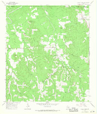
1967 Map of Cherry Spring
USGS Topo · Published 1969About this map
The boundary of Mason Co and Gillespie Co divides this Texas Hill Country landscape, dominated by a complex network of waterways including Onion Creek, Threadgill Creek, and the winding Squaw Creek. The settlement of Cherry Spring serves as a local hub near the northeast corner, while Doss appears at the western edge. This 1967 survey reveals a deeply rooted rural community, marked by family-named landmarks like Brockmann Point, Lehmann Mountain, and Mund Hill. Genealogists will find significant value in the numerous burial sites and houses of worship scattered throughout the terrain, including Lange Cem, Welge Cem, Evers Cem, and the Squaw Creek Ch. The presence of the Welge Ranch Landing Strip and the Neyland Mine indicates the varied ranching and industrial activities of the late 1960s, while the Community Center on Squaw Creek points to the social heart of the area.
Find a feature on this map
39 named features on this map. Tap any name to fly to it.
Don’t see what you’re looking for? This feature index may not catch every label — zoom into the map to look around manually.
Map Details
Editions of this 1967 Cherry Spring Map
This is the sole edition of this map. No revisions or reprints were ever made.
Other maps of this area

1887 · Llano
USGS Topo · 1:125,000

1887 · Mason
USGS Topo · 1:125,000

1894 · Mason
USGS Topo · 1:125,000

1894 · Fredericksburg
USGS Topo · 1:125,000

1894 · Kerrville
USGS Topo · 1:125,000

1894 · Llano
USGS Topo · 1:125,000

1904 · Llano
USGS Topo · 1:125,000

1909 · Llano
USGS Topo · 1:125,000

1918 · Llano
USGS Topo · 1:125,000

1954 · Llano
USGS Topo · 1:250,000