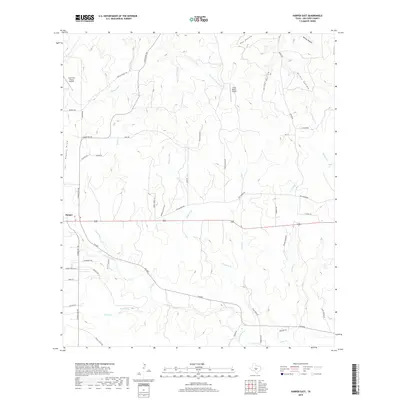
2019 Map of Harper East
USGS Topo · Published 2019About this map
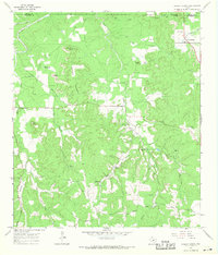
The Pedernales River meanders through this portion of Gillespie County, carving a path through the limestone-influenced landscape of the Texas Hill Country. The community of Harper serves as a primary local hub, where N Ranch Rd 783 and FM 2093 intersect with the highway corridor. Aviation activity is noted at the Lone Star Flying Service and the Circle Ranch Airport, reflecting the region's reliance on private airstrips for ranching and transportation. The topography is defined by numerous drainage systems, including Threadgill Cr, Stuckens Br, and Walnut Cr, which flow into deep-set draws and hollows such as Fox Hollow and Priess Hollow. A network of named local roads like Gammenthaler Ln and Old Tivydale Rd provides a detailed look at contemporary land division and property access points near Pecan Spring.
Find a feature on this map
52 named features on this map. Tap any name to fly to it.
Don’t see what you’re looking for? This feature index may not catch every label — zoom into the map to look around manually.
Map Details
Editions of this 2019 Harper East Map
This is the sole edition of this map. No revisions or reprints were ever made.
Other maps of this area

1894 · Kerrville
USGS Topo · 1:125,000

1954 · Llano
USGS Topo · 1:250,000

1955 · Llano
USGS Topo · 1:250,000

1956 · Llano
USGS Topo · 1:250,000

1964 · Morris Ranch
USGS Topo · 1:24,000

1964 · Nott Branch
USGS Topo · 1:24,000
1964 · Mountain Home
USGS Topo · 1:24,000
1967 · Harper East
USGS Topo · 1:24,000
1967 · Doss
USGS Topo · 1:24,000
1967 · Cherry Spring
USGS Topo · 1:24,000