2022 Map of Harper
USGS Topo · Published 2022About this map
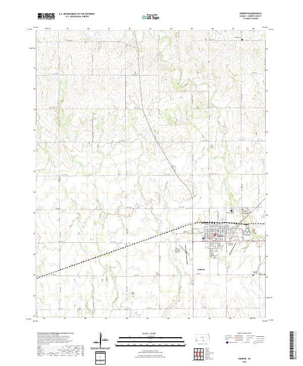
The city of Harper serves as a central hub in this Southern Kansas landscape, where the town grid is meticulously detailed with street names from Washington St to Boone St. Located at the intersection of local routes and aviation interests, the area is home to both Harper Municipal Airport and the smaller Deweze Airport. The surrounding rural territory is defined by a rigorous sectional road system, including NW 150 Rd and NW 70 Rd, which navigate the drainage basins of Spring Creek, Rush Creek, and Sand Creek. Genealogists will find three distinct burial sites recorded here: Hillsdale Cemetery in the north, Harper Cemetery near the city center, and the Christian Apostolic Cemetery located to the southeast. These features, along with the proximity of Anthony to the south, provide a clear view of the region's modern settlement pattern and agricultural organization.
Find a feature on this map
67 named features on this map. Tap any name to fly to it.
Don’t see what you’re looking for? This feature index may not catch every label — zoom into the map to look around manually.
Map Details
Editions of this 2022 Harper Map
This is the sole edition of this map. No revisions or reprints were ever made.