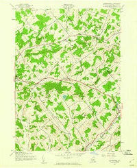
1945 Map of Harpersfield
USGS Topo · Published 1960About this map
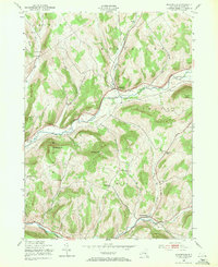
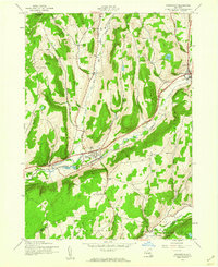
The town of Harpersfield and the neighboring hills of the Schoharie and Delaware County line are captured here following a mid-1940s field check. This upland landscape is defined by its rural infrastructure, featuring a series of small schoolhouses such as School No 5 and School No 6 that served the scattered farming settlements. In the southeast corner, the village of Stamford serves as a local hub where the New York Central railroad tracks run parallel to the West Branch Delaware River.
Find a feature on this map
39 named features on this map. Tap any name to fly to it.
Don’t see what you’re looking for? This feature index may not catch every label — zoom into the map to look around manually.
Map Details
Editions of this 1945 Harpersfield Map
2 editions found

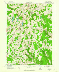
Other maps of this area

1904 · Richmondville
USGS Topo · 1:62,500

1904 · Hobart
USGS Topo · 1:62,500
1907 · Cooperstown
USGS Topo · 1:62,500
1909 · Cooperstown
USGS Topo · 1:62,500

1909 · Delhi
USGS Topo · 1:62,500
1911 · Delhi
USGS Topo · 1:62,500
1943 · Bloomville
USGS Topo · 1:24,000

1943 · Charlotteville
USGS Topo · 1:24,000
1943 · Schenevus
USGS Topo · 1:24,000
1943 · Summit
USGS Topo · 1:24,000