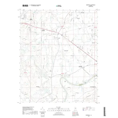
2018 Map of Harpersville
USGS Topo · Published 2018About this map
Harpersville and Wilsonville anchor this 2018 survey of the Coosa River valley, showing a landscape defined by its proximity to Lay Lake and the shifting channels of the Coosa River. The map illustrates the transition from the elevated Moore Mtn in the northwest down toward the wide alluvial plains where Old Glade Swamp and Deer Lick Br drain toward the river. For genealogists, the map is remarkably dense with family-named landmarks and historical burial grounds, including the Masters Cem, Williamson Cem, and the uniquely plural Wallace Cemeteries near Klein. The region’s rural settlement pattern is traced through several crossroads communities such as Gallups Crossroads and Chancellor Crossroads, while the southern border features the industrial and residential fringes of Childersburg. Transportation remains centered on historical corridors like Co RD 280 and the winding Dead Hollow Rd S, which follow the natural contours of the valley floor between the river bends like Cosper Bend.
Find a feature on this map
128 named features on this map. Tap any name to fly to it.
Don’t see what you’re looking for? This feature index may not catch every label — zoom into the map to look around manually.
Map Details
Editions of this 2018 Harpersville Map
This is the sole edition of this map. No revisions or reprints were ever made.
Other maps of this area

1890 · Bessemer
USGS Topo · 1:125,000

1890 · Talladega
USGS Topo · 1:125,000

1892 · Talladega
USGS Topo · 1:125,000

1892 · Bessemer
USGS Topo · 1:125,000

1906 · Vandiver
USGS Topo · 1:62,500

1908 · Vandiver
USGS Topo · 1:62,500

1909 · Columbiana
USGS Topo · 1:62,500

1911 · Columbiana
USGS Topo · 1:62,500

1915 · Gantts Quarry
USGS Topo · 1:48,000

1917 · Gantts Quarry
USGS Topo · 1:62,500