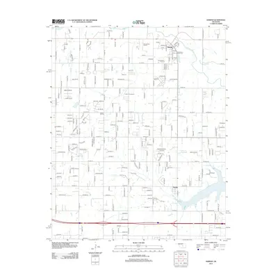
2012 Map of Harrah
USGS Topo · Published 2012About this map
The North Canadian River winds through the northern reaches of Harrah, Oklahoma, anchoring a landscape where rural roots meet modern aviation and expanding residential corridors. This 2012 survey reveals the town's grid around Main St and Navarre, bordered by family and community history recorded in the Harrah Memory Lane Cem and Saint Teresa's Catholic Cem. To the south, the community of Newalla sits near the drainage of N Deer Cr, reflecting the region's agricultural pattern interspersed with private aviation sites like Steciak Strip Airport and Lower Forty Airport. Local genealogists will find value in the various burial grounds scattered across the quadrangle, including the Kansas Sch Cem and the Jager Cem, which mark the early homesteads and school districts that shaped Oklahoma County.
Find a feature on this map
126 named features on this map. Tap any name to fly to it.
Don’t see what you’re looking for? This feature index may not catch every label — zoom into the map to look around manually.
Map Details
Editions of this 2012 Harrah Map
This is the sole edition of this map. No revisions or reprints were ever made.
Other maps of this area

1892 · Moore
USGS Topo · 1:62,500

1892 · Edmond
USGS Topo · 1:62,500

1898 · Purcell
USGS Topo · 1:125,000

1909 · Luther
USGS Topo · 1:62,500

1930 · McLoud
USGS Topo · 1:62,500

1934 · Moore
USGS Topo · 1:62,500

1935 · Edmond
USGS Topo · 1:48,000

1938 · Moore
USGS Topo · 1:62,500

1940 · Edmond
USGS Topo · 1:62,500

1954 · Oklahoma City
USGS Topo · 1:250,000