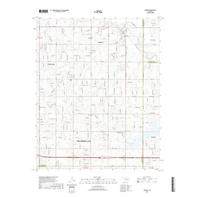
2018 Map of Harrah
USGS Topo · Published 2018About this map
The North Canadian River meanders across the northern portion of this landscape, marking the northern edge of Harrah and passing near Saint Teresa's Catholic Cem. This 2018 survey documents the residential expansion of the far eastern Oklahoma City metropolitan area, where established towns like Choctaw and Newalla maintain their distinct identities amidst a growing grid of roads such as NE 23rd St and E Reno Ave. Local history is preserved in small, localized sites like the Kansas School Cem and Jager Cem, which remain as markers of earlier rural communities. To the southeast, the outskirts of McLoud appear near the Pottawatomie County line, while the drainage of N Deer Cr shapes the central terrain. The map captures a specific moment of transition where large parcels and rural drainages meet modern suburban infill.
Find a feature on this map
50 named features on this map. Tap any name to fly to it.
Don’t see what you’re looking for? This feature index may not catch every label — zoom into the map to look around manually.
Map Details
Editions of this 2018 Harrah Map
This is the sole edition of this map. No revisions or reprints were ever made.
Other maps of this area

1892 · Moore
USGS Topo · 1:62,500

1892 · Edmond
USGS Topo · 1:62,500

1898 · Purcell
USGS Topo · 1:125,000

1909 · Luther
USGS Topo · 1:62,500

1930 · McLoud
USGS Topo · 1:62,500

1934 · Moore
USGS Topo · 1:62,500

1935 · Edmond
USGS Topo · 1:48,000

1938 · Moore
USGS Topo · 1:62,500

1940 · Edmond
USGS Topo · 1:62,500

1954 · Oklahoma City
USGS Topo · 1:250,000