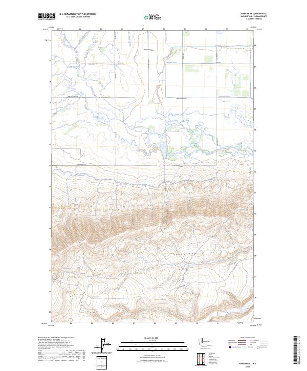
2023 Map of Harrah SE
USGS Topo · Published 2023About this map
Yakima Valley agricultural lands and conservation areas dominate this recent 2023 study of the territory south of Harrah. The map illustrates a complex water management system essential for local farming, featuring the Unit 2 Canal, Marion Drain, and numerous smaller waterways like East Island Lateral and Mud Lake Drain. A significant portion of the landscape is dedicated to the Toppenish National Wildlife Refuge, which protects the riparian corridors along Toppenish Creek. To the south, the topography shifts dramatically as the valley floor rises into Toppenish Ridge, where the terrain is marked by remote drainage points like Dry Creek and Oak Spring. This survey provides a contemporary record of the Yakima Nation lands, showing the network of Bureau of Indian Affairs routes including BIA Rd 75 and BIA Rd 144 that traverse the ridge and valley slopes.
Find a feature on this map
32 named features on this map. Tap any name to fly to it.
Don’t see what you’re looking for? This feature index may not catch every label — zoom into the map to look around manually.
Map Details
Editions of this 2023 Harrah SE Map
This is the sole edition of this map. No revisions or reprints were ever made.
Other maps of this area

1910 · Zillah
USGS Topo · 1:125,000

1937 · White Swan
USGS Topo · 1:125,000

1950 · Yakima
USGS Topo · 1:250,000

1958 · Toppenish SW
USGS Topo · 1:24,000

1958 · Toppenish Mtn.
USGS Topo · 1:24,000

1958 · Harrah
USGS Topo · 1:24,000

1958 · White Swan
USGS Topo · 1:24,000

1958 · Harrah SE
USGS Topo · 1:24,000
1958 · Wapato
USGS Topo · 1:24,000

1958 · Yakima
USGS Topo · 1:250,000