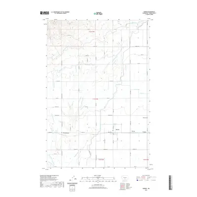
2020 Map of Harrah
USGS Topo · Published 2020About this map
Harrah and the neighboring community of Brownstown anchor this agricultural landscape in the Yakima Valley, where a sophisticated irrigation network defines the land's utility. The area is intersected by an intricate system of water management features, including the Main Canal, W Unit One Highline Canal, and the Main Canal Extension, which feed numerous named laterals such as the Vogler Lateral and Wilbur Lateral. These man-made channels contrast with the natural course of Toppenish Cr in the south, illustrating the transition from wild riparian zones to a highly engineered farming environment. Smaller settlements like Farron and Venner appear along the east-west corridor of Branch Rd, which serves as a primary artery connecting these rural hubs. The presence of specialized drainage features like the Olney Flat Drain and Leclair Drain highlights the ongoing effort to manage the local water table for productive viticulture or fruit production characteristic of this region.
Find a feature on this map
107 named features on this map. Tap any name to fly to it.
Don’t see what you’re looking for? This feature index may not catch every label — zoom into the map to look around manually.
Map Details
Editions of this 2020 Harrah Map
This is the sole edition of this map. No revisions or reprints were ever made.
Other maps of this area

1899 · Ellensburg
USGS Topo · 1:125,000

1901 · Ellensburg
USGS Topo · 1:125,000

1910 · Zillah
USGS Topo · 1:125,000

1936 · Yakima East
USGS Topo · 1:48,000

1937 · White Swan
USGS Topo · 1:125,000

1941 · Yakima East
USGS Topo · 1:62,500

1950 · Yakima
USGS Topo · 1:250,000

1953 · Yakima East
USGS Topo · 1:24,000
1953 · Yakima East
USGS Topo · 1:62,500

1958 · Toppenish SW
USGS Topo · 1:24,000