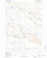
1958 Map of Harris Bridge
USGS Topo · Published 1977About this map
Wyoming Canal and a complex network of lateral irrigation lines define the character of this landscape in the high desert of Fremont County. This 1958 revision captures a period of intensive water management, where the Riverton Reclamation Withdrawal Area and Wind River Indian Reservation intersect. The map documents the engineering used to move water across the arid terrain, including a Siphon and Spillway that facilitate the flow of the Muddy Creek.
Find a feature on this map
18 named features on this map. Tap any name to fly to it.
Don’t see what you’re looking for? This feature index may not catch every label — zoom into the map to look around manually.
Map Details
Editions of this 1958 Harris Bridge Map
3 editions found
Other maps of this area

1950 · Pavillion
USGS Topo · 1:24,000

1950 · Pavillion Butte
USGS Topo · 1:24,000

1950 · Harris Bridge
USGS Topo · 1:24,000

1950 · Mexican Pass SW
USGS Topo · 1:24,000

1950 · Ocean Lake
USGS Topo · 1:24,000

1950 · Shotgun Butte
USGS Topo · 1:24,000

1951 · Mexican Pass
USGS Topo · 1:24,000

1951 · Jenkins Mountain
USGS Topo · 1:24,000

1952 · Lost Wells Butte
USGS Topo · 1:24,000

1955 · Thermopolis
USGS Topo · 1:250,000