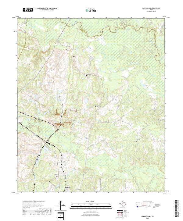
2022 Map of Harris Chapel
USGS Topo · Published 2022About this map
The Sabine River snakes across the northern reaches of Panola County, defining a landscape of wetlands and complex hydrology including Cypress Slough, Trout Lake, and Redman Lakes. This area of East Texas is characterized by a dense network of tributaries such as Elijah Br and Potters Cr that feed into the river valley. The map documents a predominantly rural region where small settlements like Tatum and Beckville serve as anchor points for a spiderweb of county roads and farm-to-market routes.
Find a feature on this map
57 named features on this map. Tap any name to fly to it.
Don’t see what you’re looking for? This feature index may not catch every label — zoom into the map to look around manually.
Map Details
Editions of this 2022 Harris Chapel Map
This is the sole edition of this map. No revisions or reprints were ever made.
Other maps of this area

1956 · Tyler
USGS Topo · 1:250,000

1958 · Darco
USGS Topo · 1:62,500

1958 · Carthage
USGS Topo · 1:62,500

1958 · Tatum
USGS Topo · 1:62,500

1960 · Minden
USGS Topo · 1:62,500

1983 · Grand Bluff
USGS Topo · 1:24,000

1983 · Tatum
USGS Topo · 1:24,000

1983 · Harris Chapel
USGS Topo · 1:24,000

1983 · Easton
USGS Topo · 1:24,000

1983 · Fair Play
USGS Topo · 1:24,000