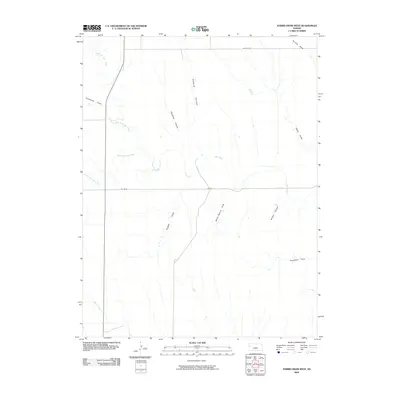
2009 Map of Harris Draw West
USGS Topo · Published 2009About this map
North Fork Lake Creek and South Fork Lake Creek converge in this section of Wallace County, defining a landscape of high plains drainage systems in the first decade of the 21st century. The map provides a clear look at the intricate network of canyons and draws that feed into these larger waterways, reflecting the specific topography of the western Kansas prairie. Named features like Kolacny Canyon, Blindman Canyon, and Wildcat Canyon suggest a history of local land naming based on either notable inhabitants or the character of the terrain itself. These erosional features, alongside various draws such as Ruggles Draw and Barrel Spring Draw, demonstrate how water has shaped the regional geography over time. The presence of rural routes like RD Wa Ez and RD Wa E DD shows the grid-based infrastructure typical of the area, providing access across the open stretches between Lake Creek and Pond Creek.
Find a feature on this map
16 named features on this map. Tap any name to fly to it.
Don’t see what you’re looking for? This feature index may not catch every label — zoom into the map to look around manually.
Map Details
Editions of this 2009 Harris Draw West Map
This is the sole edition of this map. No revisions or reprints were ever made.
Other maps of this area

1954 · Goodland
USGS Topo · 1:250,000

1955 · Scott City
USGS Topo · 1:250,000

1956 · Goodland
USGS Topo · 1:250,000

1957 · Goodland
USGS Topo · 1:250,000

1958 · Scott City
USGS Topo · 1:250,000

1959 · Weskan
USGS Topo · 1:62,500

1959 · Wallace
USGS Topo · 1:62,500

1959 · Harris Draw
USGS Topo · 1:62,500

1959 · Horsethief Draw
USGS Topo · 1:62,500
1979 · Wallace
USGS Topo · 1:24,000