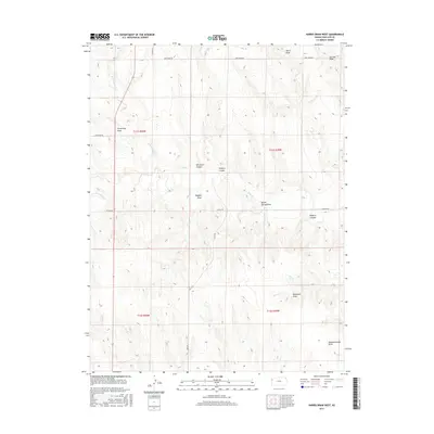
2015 Map of Harris Draw West
USGS Topo · Published 2015About this map
The high plains of Wallace County are defined here by a network of drainage systems feeding into Lake Cr and its tributaries, including N Fork Lake Cr and S Fork Lake Cr. This landscape is deeply carved by named draws and canyons that reveal the names of the families who settled this part of western Kansas. Features like Armstrong Draw, Ruggles Draw, and Depperschmidt Draw anchor the geography to local history, while Blindman Canyon and Wildcat Canyon hint at the area's natural landmarks. In a region where water is a vital resource, Big Spring and Pond Cr stand out as critical points on the map. The local infrastructure is represented by a grid of rural routes such as Deer Draw Rd, Zigzag Rd, and Blue Bird Rd, showing how modern transport follows the historic township and range lines of the American West.
Find a feature on this map
24 named features on this map. Tap any name to fly to it.
Don’t see what you’re looking for? This feature index may not catch every label — zoom into the map to look around manually.
Map Details
Editions of this 2015 Harris Draw West Map
This is the sole edition of this map. No revisions or reprints were ever made.
Other maps of this area

1954 · Goodland
USGS Topo · 1:250,000

1955 · Scott City
USGS Topo · 1:250,000

1956 · Goodland
USGS Topo · 1:250,000

1957 · Goodland
USGS Topo · 1:250,000

1958 · Scott City
USGS Topo · 1:250,000

1959 · Weskan
USGS Topo · 1:62,500

1959 · Wallace
USGS Topo · 1:62,500

1959 · Harris Draw
USGS Topo · 1:62,500

1959 · Horsethief Draw
USGS Topo · 1:62,500
1979 · Wallace
USGS Topo · 1:24,000