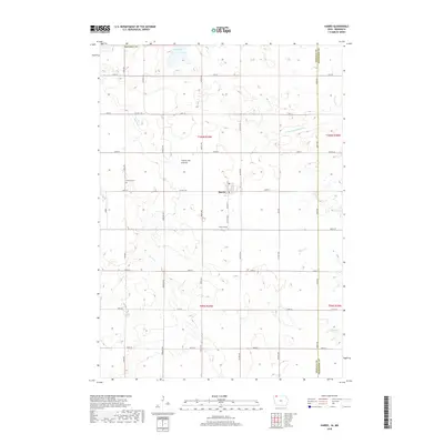
2018 Map of Harris
USGS Topo · Published 2018About this map
Harris serves as the central hub of this agricultural landscape in Osceola County, situated along the higher ground of the Coteau des Prairies. This landform, a prominent plateau, dictates the drainage patterns for several waterways, including the headwaters of the W Br Little Sioux River and the winding course of Dugout Cr. The town is flanked by historic burial grounds, with Fairview Cem located to the west and Union Cem to the south, providing clear points of interest for genealogical researchers.
Find a feature on this map
36 named features on this map. Tap any name to fly to it.
Don’t see what you’re looking for? This feature index may not catch every label — zoom into the map to look around manually.
Map Details
Editions of this 2018 Harris Map
This is the sole edition of this map. No revisions or reprints were ever made.
Other maps of this area

1954 · Fairmont
USGS Topo · 1:250,000

1958 · Fairmont
USGS Topo · 1:250,000

1960 · Worthington South
USGS Topo · 1:24,000

1960 · Round Lake
USGS Topo · 1:24,000

1960 · Sioux Valley
USGS Topo · 1:24,000

1970 · Lake Park SE
USGS Topo · 1:24,000

1970 · May City
USGS Topo · 1:24,000

1970 · Harris
USGS Topo · 1:24,000
1970 · Lake Park
USGS Topo · 1:24,000

1972 · Ocheyedan
USGS Topo · 1:24,000