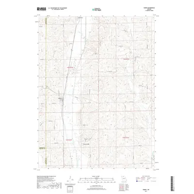
2017 Map of Harris
USGS Topo · Published 2017About this map
Newtown, Harris, and Wintersville serve as the primary hubs within this section of rural North Missouri, situated at the meeting point of Sullivan, Mercer, and Grundy counties. The landscape is defined by the winding course of Medicine Creek and W Locust Cr, which carve through the agricultural uplands. A network of county and state routes, including State Hwy KK and State Hwy EE, connects these small communities and isolated farmsteads. For those exploring family history, several burial grounds are preserved across the townships, such as Wintersville Cem near the southern boundary and Brackett Cem to the east. The map illustrates a contemporary rural environment where historical settlement patterns persist through these established towns and well-maintained local roads like Kingston Rd and Liberty Rd.
Find a feature on this map
48 named features on this map. Tap any name to fly to it.
Don’t see what you’re looking for? This feature index may not catch every label — zoom into the map to look around manually.
Map Details
Editions of this 2017 Harris Map
This is the sole edition of this map. No revisions or reprints were ever made.
Other maps of this area

1946 · Galt
USGS Topo · 1:62,500

1949 · Galt
USGS Topo · 1:62,500

1954 · Centerville
USGS Topo · 1:250,000

1957 · Centerville
USGS Topo · 1:250,000

1958 · Centerville
USGS Topo · 1:250,000

1964 · Pollock NW
USGS Topo · 1:24,000

1964 · Ravanna
USGS Topo · 1:24,000

1964 · Harris
USGS Topo · 1:24,000

1964 · Half Rock
USGS Topo · 1:24,000

1964 · Milan West
USGS Topo · 1:24,000