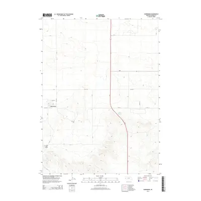
2014 Map of Harrisburg
USGS Topo · Published 2014About this map
Harrisburg serves as the focal point of this Banner County survey, situated at the junction of Canyon Rd and the NE-4A Spur. As the county seat, the village layout is clearly defined, featuring a concentrated grid including Park Row and the local Po. The surrounding High Plains terrain is marked by significant elevation changes, most notably at Lovers Leap Butte to the southwest and the escarpments overlooking the Downer Brothers Reservoir. Local history is anchored by the Harrisburg Cem located southeast of the main settlement. The map illustrates a transitional landscape where the rigid section-line road network, including CR-39 and Co Road 26, navigates around the dramatic breaks and ridges that characterize this portion of the Nebraska Panhandle.
Find a feature on this map
18 named features on this map. Tap any name to fly to it.
Don’t see what you’re looking for? This feature index may not catch every label — zoom into the map to look around manually.
Map Details
Editions of this 2014 Harrisburg Map
This is the sole edition of this map. No revisions or reprints were ever made.
Other maps of this area

1898 · Scotts Bluff
USGS Topo · 1:125,000

1954 · Scottsbluff
USGS Topo · 1:250,000

1958 · Scottsbluff
USGS Topo · 1:250,000

1973 · Scotts Bluff 4 NW
USGS Topo · 1:24,000

1973 · Kimball 2 NE
USGS Topo · 1:24,000

1973 · Scotts Bluff 4 SE
USGS Topo · 1:24,000

1973 · Scotts Bluff 4 NE
USGS Topo · 1:24,000

1973 · Scotts Bluff 4 SW
USGS Topo · 1:24,000

1973 · Scotts Bluff 3 SE
USGS Topo · 1:24,000

1973 · Kimball 1 NE
USGS Topo · 1:24,000