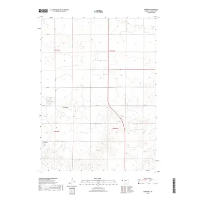
2017 Map of Harrisburg
USGS Topo · Published 2017About this map
Harrisburg serves as the focal point of this high plains landscape, situated within the expansive survey boundaries of Banner County. The small community is concentrated along Park St and Co Rd 18, anchored by a Po that highlights its role as a regional hub for the surrounding ranching and agricultural operations. South of the main settlement, the Harrisburg Cem provides a vital record for genealogists researching the families of T18N and T19N. The topography is defined by the sudden rise of Lovers Leap Butte in the southwest, a sharp geographical break from the steady grid of county roads. This network, including Co Rd 24 and Co Rd 39, illustrates the structured land management typical of the Nebraska panhandle, where long-distance transit routes intersect at right angles across the open terrain.
Find a feature on this map
17 named features on this map. Tap any name to fly to it.
Don’t see what you’re looking for? This feature index may not catch every label — zoom into the map to look around manually.
Map Details
Editions of this 2017 Harrisburg Map
This is the sole edition of this map. No revisions or reprints were ever made.
Other maps of this area

1898 · Scotts Bluff
USGS Topo · 1:125,000

1954 · Scottsbluff
USGS Topo · 1:250,000

1958 · Scottsbluff
USGS Topo · 1:250,000

1973 · Scotts Bluff 4 NW
USGS Topo · 1:24,000

1973 · Kimball 2 NE
USGS Topo · 1:24,000

1973 · Scotts Bluff 4 SE
USGS Topo · 1:24,000

1973 · Scotts Bluff 4 NE
USGS Topo · 1:24,000

1973 · Scotts Bluff 4 SW
USGS Topo · 1:24,000

1973 · Scotts Bluff 3 SE
USGS Topo · 1:24,000

1973 · Kimball 1 NE
USGS Topo · 1:24,000