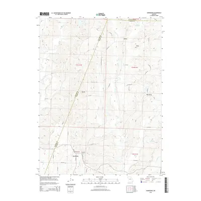
2014 Map of Harrisburg
USGS Topo · Published 2014About this map
Harrisburg serves as the primary hub of this Central Missouri landscape, where the agricultural uplands are deeply dissected by the drainage systems of Moniteau Cr and Perche Cr. The terrain reflects a complex network of rural life defined by early 21st-century county roads and local routes like W Highway 124 and the descriptively named N Devils Washboard Rd. Small, localized settlements such as Minnie, Rucker, and Rileysburg are scattered across the quadrangle, illustrating the persistent importance of named crossroads in this region. Genealogists will find the locations of the Harrisburg Cemetery and Robison Cemetery particularly valuable for tracing local heritage. Water features like Charles Hood Lake and Monte Gurwit Lake provide distinct landmarks amidst the winding courses of Lick Fork and Coon Cr, which shaped the historical development and movement patterns of Boone County and its neighbors.
Find a feature on this map
67 named features on this map. Tap any name to fly to it.
Don’t see what you’re looking for? This feature index may not catch every label — zoom into the map to look around manually.
Map Details
Editions of this 2014 Harrisburg Map
This is the sole edition of this map. No revisions or reprints were ever made.
Other maps of this area

1890 · Moberly
USGS Topo · 1:125,000

1890 · Glasgow
USGS Topo · 1:125,000

1917 · Sturgeon
USGS Topo · 1:62,500

1952 · Hilldale
USGS Topo · 1:24,000

1953 · Moberly
USGS Topo · 1:250,000

1953 · Burton
USGS Topo · 1:24,000

1953 · Renick
USGS Topo · 1:24,000

1953 · Higbee
USGS Topo · 1:24,000

1953 · Clark
USGS Topo · 1:24,000

1954 · Moberly
USGS Topo · 1:250,000