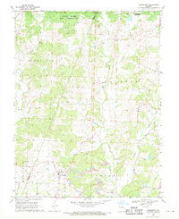
1969 Map of Harrisburg
USGS Topo · Published 1971About this map
Harrisburg stands as the primary hub of this Central Missouri landscape, where the agricultural plateaus are deeply dissected by the drainages of Moniteau Creek, Perche Creek, and Callahan Cr. The map reveals a transition in land use, featuring the sprawling Rudolf Bennitt State Wildlife Area in the northern reaches across the Randolph County line, contrasting with active Strip Mine operations scattered near the waterways.
Find a feature on this map
25 named features on this map. Tap any name to fly to it.
Don’t see what you’re looking for? This feature index may not catch every label — zoom into the map to look around manually.
Map Details
Editions of this 1969 Harrisburg Map
2 editions found
Other maps of this area

1890 · Moberly
USGS Topo · 1:125,000

1890 · Glasgow
USGS Topo · 1:125,000

1917 · Sturgeon
USGS Topo · 1:62,500

1952 · Hilldale
USGS Topo · 1:24,000

1953 · Moberly
USGS Topo · 1:250,000

1953 · Burton
USGS Topo · 1:24,000

1953 · Renick
USGS Topo · 1:24,000

1953 · Higbee
USGS Topo · 1:24,000

1953 · Clark
USGS Topo · 1:24,000

1954 · Moberly
USGS Topo · 1:250,000