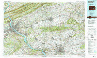
1984 Map of Harrisburg
USGS Topo · Published 1988About this map
The Susquehanna River carves a deep valley through the ridge-and-valley province, defining the western edge of this 1980s landscape. Along its banks, the industrial and political centers of Harrisburg and Steelton are clearly mapped, showing the dense urban corridors that developed alongside Conrail and Amtrak rail lines. To the north, the dramatic folds of Blue Mountain and Second Mountain form a natural barrier, punctuated by the massive Fort Indian Town Gap Military Reservation and vast tracts of State Game Lands No 211.
Find a feature on this map
155 named features on this map. Tap any name to fly to it.
Don’t see what you’re looking for? This feature index may not catch every label — zoom into the map to look around manually.
Map Details
Editions of this 1984 Harrisburg Map
2 editions found
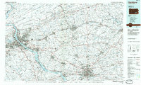
Other maps of this area

1889 · Pottsville
USGS Topo · 1:62,500

1891 · Pottsville
USGS Topo · 1:62,500

1891 · Lebanon
USGS Topo · 1:62,500

1892 · Lykens
USGS Topo · 1:62,500

1892 · Hummelstown
USGS Topo · 1:62,500

1892 · Harrisburg
USGS Topo · 1:62,500

1892 · Pine Grove
USGS Topo · 1:62,500

1893 · Lykens
USGS Topo · 1:62,500

1893 · Lebanon
USGS Topo · 1:62,500

1893 · Millersburg
USGS Topo · 1:62,500
Featured Places
- Lancaster, PA
- Harrisburg, PA
- Lebanon, PA
- Colonial Park, Lower Paxton Township
- West Lampeter Township, PA