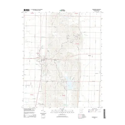
2014 Map of Harrisburg
USGS Topo · Published 2014About this map
Harrisburg serves as the focal point of this Poinsett County landscape, showing its organized street grid and proximity to the regional water network. To the east, the terrain transitions into the lowlands of the Mississippi Delta, marked by the agricultural community of Whitaker. Significant water features like Lake Poinsett and the Poinsett Watershed Site Three Reservoir dominate the southern half of the map, illustrating the importance of water management and recreation to the local area. For genealogists and local historians, the map is a valuable resource for locating family burial grounds, including the Harris Cem, Holly Springs Cem, and Farm Hill Cem. The land is dissected by numerous branches and creeks, such as Holly Springs Br and Distress Cr, which follow the natural contours of the ridge before spilling into the flatter eastern plains.
Find a feature on this map
119 named features on this map. Tap any name to fly to it.
Don’t see what you’re looking for? This feature index may not catch every label — zoom into the map to look around manually.
Map Details
Editions of this 2014 Harrisburg Map
This is the sole edition of this map. No revisions or reprints were ever made.
Other maps of this area

1939 · Vanndale
USGS Topo · 1:62,500

1939 · Weiner
USGS Topo · 1:62,500

1940 · Princedale
USGS Topo · 1:62,500

1940 · Dee
USGS Topo · 1:62,500

1953 · Memphis
USGS Topo · 1:250,000

1956 · Memphis
USGS Topo · 1:250,000

1956 · Princedale
USGS Topo · 1:62,500

1958 · Dee
USGS Topo · 1:62,500

1958 · Vanndale
USGS Topo · 1:62,500

1959 · Weiner
USGS Topo · 1:62,500