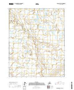
2017 Map of Harrison Bay A-1 NE
USGS Topo · Published 2017About this map
The Miluveach River winds through this section of the North Slope, illustrating the intricate, water-dominated geography of the Alaskan arctic. This 2017 study captures a landscape defined by braided waterways and thermokarst features, where the river and Kalubik Cr dictate the natural drainage patterns across the tundra. The absence of roads or permanent settlements within the survey area reflects the wilderness character of the region, emphasizing the importance of these named watercourses for navigation and traditional land use. Researchers can observe the seasonal complexity of the terrain through the detailed hydrography, which remains the primary defining characteristic of the local environment within the various township boundaries.
Find a feature on this map
6 named features on this map. Tap any name to fly to it.
Don’t see what you’re looking for? This feature index may not catch every label — zoom into the map to look around manually.
Map Details
Editions of this 2017 Harrison Bay A-1 NE Map
This is the sole edition of this map. No revisions or reprints were ever made.
Other maps of this area

1951 · Harrison Bay
USGS Topo · 1:250,000

1951 · Beechey Point
USGS Topo · 1:250,000

1955 · Harrison Bay
USGS Topo · 1:250,000

1955 · Beechey Point
USGS Topo · 1:250,000

1955 · Harrison Bay B-1
USGS Topo · 1:63,360

1955 · Beechey Point A-5
USGS Topo · 1:63,360

1955 · Beechey Point B-5
USGS Topo · 1:63,360
1955 · Harrison Bay A-1
USGS Topo · 1:63,360

1960 · Beechey Point
USGS Topo · 1:250,000
1962 · Harrison Bay B-1
USGS Topo · 1:50,000