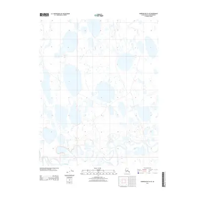
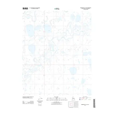
2013 Map of Harrison Bay B-4 SE
USGS Topo · Published 2013About this map
Fish Creek meanders through the southern reaches of this Arctic landscape, creating a complex network of oxbows and marshy drainages that contrast with the static, pockmarked tundra of the northern sections. This 2013 survey of the Alaska-North Slope Borough reveals a terrain defined by thermokarst processes, where hundreds of shallow lakes and ponds saturate the land between the township lines of T 12 N and T 11 N. The map captures a moment in the modern era of the North Slope where the land remains largely undeveloped, preserving a wilderness drainage system free of permanent settlements or industrial infrastructure. Researchers and environmental historians can trace the intricate hydrology of the Fish Creek basin, observing how its winding channel navigates the subtle elevation changes of this coastal plain.
Find a feature on this map
4 named features on this map. Tap any name to fly to it.
Don’t see what you’re looking for? This feature index may not catch every label — zoom into the map to look around manually.
Map Details
Editions of this 2013 Harrison Bay B-4 SE Map
This is the sole edition of this map. No revisions or reprints were ever made.
Other maps of this area

1951 · Harrison Bay
USGS Topo · 1:250,000

1955 · Harrison Bay
USGS Topo · 1:250,000

1955 · Harrison Bay A-4
USGS Topo · 1:63,360

1955 · Harrison Bay B-3
USGS Topo · 1:63,360

1955 · Harrison Bay A-3
USGS Topo · 1:63,360

1955 · Harrison Bay B-4
USGS Topo · 1:63,360
1962 · Harrison Bay B-3
USGS Topo · 1:50,000
2013 · Harrison Bay A-4 NW
USGS Topo · 1:25,000
2013 · Harrison Bay B-3 SW
USGS Topo · 1:25,000
2013 · Harrison Bay A-4 NE
USGS Topo · 1:25,000