
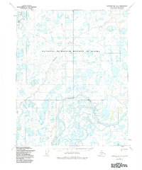
1955 Map of Harrison Bay A-3
USGS Topo · Published 1970About this map
Naval Petroleum Reserve No 4 dominates this 1955 survey of the Arctic coastal plain, a landscape defined by an intricate network of thaw lakes and meandering watercourses. The mighty Colville River sweeps through the southern portion of the quadrangle, carving significant landmarks like the Big Bend and the elevated terrain at Ocean Point. This mid-century military and geological assessment captures the region before extensive industrial infrastructure arrived, showing only a solitary Tractor Trail cutting through the tundra north of the Ublutuoch River. Geologists and researchers can trace the natural drainage patterns of Judy Creek and observe the prominent Bluff overlooking the riverbanks, providing a foundational record of this remote North Slope environment during the early years of modern Arctic exploration.
Find a feature on this map
9 named features on this map. Tap any name to fly to it.
Don’t see what you’re looking for? This feature index may not catch every label — zoom into the map to look around manually.
Map Details
Editions of this 1955 Harrison Bay A-3 Map
2 editions found
Other maps of this area

1951 · Harrison Bay
USGS Topo · 1:250,000

1952 · Umiat
USGS Topo · 1:250,000

1955 · Harrison Bay
USGS Topo · 1:250,000

1955 · Harrison Bay A-4
USGS Topo · 1:63,360

1955 · Harrison Bay B-3
USGS Topo · 1:63,360

1955 · Harrison Bay B-2
USGS Topo · 1:63,360

1955 · Umiat D-2
USGS Topo · 1:63,360

1955 · Harrison Bay A-2
USGS Topo · 1:63,360

1955 · Harrison Bay B-4
USGS Topo · 1:63,360

1955 · Umiat D-3
USGS Topo · 1:63,360