
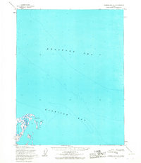
1955 Map of Harrison Bay B-3
USGS Topo · Published 1967About this map
Harrison Bay dominates the northern reaches of this coastal Alaskan landscape, where the waters of the Beaufort Sea meet a complex network of thaw lakes and winding waterways. This 1955 survey depicts a region managed as part of the Naval Petroleum Reserve No. 4, characterized by a labyrinth of interconnected hydrology. Significant drainage systems include the Fish Creek and the meandering Tingmeachsioivik Creek, which flow through the low-lying tundra toward the coast.
Find a feature on this map
6 named features on this map. Tap any name to fly to it.
Don’t see what you’re looking for? This feature index may not catch every label — zoom into the map to look around manually.
Map Details
Editions of this 1955 Harrison Bay B-3 Map
This is the sole edition of this map. No revisions or reprints were ever made.
Other maps of this area

1951 · Harrison Bay
USGS Topo · 1:250,000

1955 · Harrison Bay
USGS Topo · 1:250,000

1955 · Harrison Bay A-4
USGS Topo · 1:63,360
1955 · Harrison Bay C-3
USGS Topo · 1:63,360

1955 · Harrison Bay B-2
USGS Topo · 1:63,360

1955 · Harrison Bay A-2
USGS Topo · 1:63,360

1955 · Harrison Bay A-3
USGS Topo · 1:63,360

1955 · Harrison Bay C-4
USGS Topo · 1:63,360

1955 · Harrison Bay B-4
USGS Topo · 1:63,360
1962 · Harrison Bay C-3
USGS Topo · 1:50,000