
1955 Map of Harrison Bay C-4
USGS Topo · Published 1970About this map
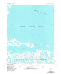
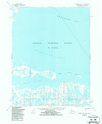
The arctic coast of the North Slope appears as a complex network of thaw lakes and coastal inlets where the Kogru River meets the shallow waters of Harrison Bay. This mid-century environment is defined by its seasonal mobility, centered on a prominent Winter Trail and a remote Landing Strip that provided essential access to the region. Human presence in this isolated landscape is marked by several specific locations, including Saktuina Point, a cluster of Ruins, and a Memorial near the coast. The offshore Eskimo Islands and surveying points like Kogru E Base illustrate the technical efforts to chart this shifting interface between the Beaufort Sea and the tundra. Scattered across the land are family or individual names such as Fred, Evelyn, Pete, and Lulu, which likely denote seasonal camps or points of local significance known to the Arctic residents and surveyors of the time.
Find a feature on this map
19 named features on this map. Tap any name to fly to it.
Don’t see what you’re looking for? This feature index may not catch every label — zoom into the map to look around manually.
Map Details
Editions of this 1955 Harrison Bay C-4 Map
3 editions found
Other maps of this area

1951 · Harrison Bay
USGS Topo · 1:250,000

1955 · Harrison Bay
USGS Topo · 1:250,000

1955 · Harrison Bay B-3
USGS Topo · 1:63,360

1955 · Harrison Bay D-4
USGS Topo · 1:63,360
1955 · Harrison Bay C-3
USGS Topo · 1:63,360

1955 · Harrison Bay C-5
USGS Topo · 1:63,360

1955 · Harrison Bay D-5
USGS Topo · 1:63,360

1955 · Harrison Bay B-5
USGS Topo · 1:63,360

1955 · Harrison Bay B-4
USGS Topo · 1:63,360

1962 · Harrison Bay C-5
USGS Topo · 1:50,000