
1955 Map of Harrison Bay D-4
USGS Topo · Published 1967About this map
Cape Halkett forms the prominent eastern boundary of the landmass on this mid-century survey, reaching into the waters where Harrison Bay meets the Beaufort Sea. This coastal environment within the Naval Petroleum Reserve No. 4 is defined by its low-lying, pond-streaked tundra, where the transition from land to the Arctic Ocean is marked by intricate inlets and shallow offshore features like Pacific Shoal.
Find a feature on this map
12 named features on this map. Tap any name to fly to it.
Don’t see what you’re looking for? This feature index may not catch every label — zoom into the map to look around manually.
Map Details
Editions of this 1955 Harrison Bay D-4 Map
This is the sole edition of this map. No revisions or reprints were ever made.
Other maps of this area

1951 · Harrison Bay
USGS Topo · 1:250,000

1955 · Harrison Bay
USGS Topo · 1:250,000
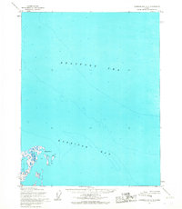
1955 · Harrison Bay C-3
USGS Topo · 1:63,360

1955 · Harrison Bay C-5
USGS Topo · 1:63,360

1955 · Harrison Bay D-5
USGS Topo · 1:63,360

1955 · Harrison Bay C-4
USGS Topo · 1:63,360

1962 · Harrison Bay C-5
USGS Topo · 1:50,000
1962 · Harrison Bay C-3
USGS Topo · 1:50,000
1962 · Harrison Bay D-4
USGS Topo · 1:50,000
1962 · Harrison Bay D-5
USGS Topo · 1:50,000