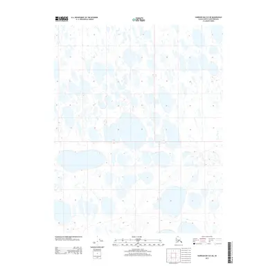
2013 Map of Harrison Bay B-5 NE
USGS Topo · Published 2013About this map
The Alaskan North Slope at the beginning of the 2010s reveals an intricate, water-saturated landscape defined by the Public Land Survey System boundaries of T 13 N, T 12 N, R 3 W, and R 2 W. This area is characterized by an extensive network of thaw lakes and ponds, a common geomorphological pattern in the permafrost-affected tundra. The topography is exceptionally level, with the 10-foot contour intervals indicating minimal elevation changes across the many square miles of marsh and water. This map captures the region’s undisturbed state, showing no permanent settlements, roads, or named geographic landmarks outside of the township and range grid lines. It is a pure representation of the Arctic coastal plain’s hydrology and physical geography prior to any documented industrial or infrastructural development in this specific quadrant.
Find a feature on this map
4 named features on this map. Tap any name to fly to it.
Don’t see what you’re looking for? This feature index may not catch every label — zoom into the map to look around manually.
Map Details
Editions of this 2013 Harrison Bay B-5 NE Map
This is the sole edition of this map. No revisions or reprints were ever made.
Other maps of this area

1951 · Harrison Bay
USGS Topo · 1:250,000

1955 · Harrison Bay
USGS Topo · 1:250,000

1955 · Harrison Bay C-5
USGS Topo · 1:63,360

1955 · Harrison Bay B-5
USGS Topo · 1:63,360

1955 · Harrison Bay C-4
USGS Topo · 1:63,360

1955 · Harrison Bay B-4
USGS Topo · 1:63,360

1962 · Harrison Bay C-5
USGS Topo · 1:50,000
2013 · Harrison Bay C-5 SW
USGS Topo · 1:25,000
2013 · Harrison Bay B-5 SW
USGS Topo · 1:25,000
2013 · Harrison Bay B-5 SE
USGS Topo · 1:25,000