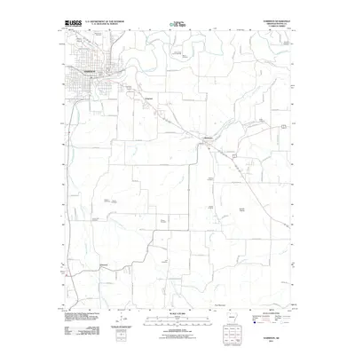
2011 Map of Harrison
USGS Topo · Published 2011About this map
Harrison serves as the focal point of this Boone County survey, situated at the junction of Crooked Creek and Dry Jordan Creek. The town's urban grid is anchored by the Harrison Post Office and several significant burial grounds, including Maplewood Cemetery, Speer Cemetery, and Rose Hill Cemetery. As the landscape transitions south and east, the map reveals a more dispersed settlement pattern characterized by the Huzzah Prairie and the hamlets of Chapman, Bellefonte, and Elmwood.
Find a feature on this map
93 named features on this map. Tap any name to fly to it.
Don’t see what you’re looking for? This feature index may not catch every label — zoom into the map to look around manually.
Map Details
Editions of this 2011 Harrison Map
This is the sole edition of this map. No revisions or reprints were ever made.
Other maps of this area

1893 · Yellville
USGS Topo · 1:125,000

1903 · Yellville
USGS Topo · 1:125,000

1904 · Harrison
USGS Topo · 1:125,000

1905 · Harrison
USGS Topo · 1:125,000

1905 · Yellville
USGS Topo · 1:125,000

1929 · Yellville
USGS Topo · 1:125,000

1945 · Harrison
USGS Topo · 1:250,000

1949 · Harrison
USGS Topo · 1:250,000

1954 · Harrison
USGS Topo · 1:250,000

1958 · Harrison
USGS Topo · 1:250,000