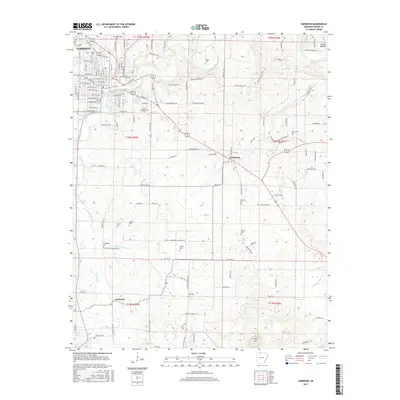
2017 Map of Harrison
USGS Topo · Published 2017About this map
Harrison serves as the focal point of this Northwest Arkansas survey, showcasing a dense grid of residential streets such as W Prospect St and Wilson Ave alongside the campus of North Arkansas Coll. The landscape is defined by the winding course of Crooked Creek and its many tributaries, including Dry Jordan Cr and E Fork Crooked Cr. The map reveals a high density of rural burial grounds, such as Maplewood Cem, Milum Cem, and Speer Cem, which often cluster near old road junctions or family homesteads. To the southeast, the terrain transitions toward the distinctive height of Pilot Mtn, while the smaller settlements of Bellefonte and Elmwood anchor the surrounding agricultural and creek-valley lands. This detailed record of the Boone County countryside documents the convergence of modern transportation and longstanding community landmarks.
Find a feature on this map
135 named features on this map. Tap any name to fly to it.
Don’t see what you’re looking for? This feature index may not catch every label — zoom into the map to look around manually.
Map Details
Editions of this 2017 Harrison Map
This is the sole edition of this map. No revisions or reprints were ever made.
Other maps of this area

1893 · Yellville
USGS Topo · 1:125,000

1903 · Yellville
USGS Topo · 1:125,000

1904 · Harrison
USGS Topo · 1:125,000

1905 · Harrison
USGS Topo · 1:125,000

1905 · Yellville
USGS Topo · 1:125,000

1929 · Yellville
USGS Topo · 1:125,000

1945 · Harrison
USGS Topo · 1:250,000

1949 · Harrison
USGS Topo · 1:250,000

1954 · Harrison
USGS Topo · 1:250,000

1958 · Harrison
USGS Topo · 1:250,000